
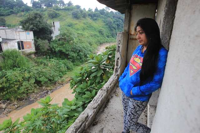
The flood of Pinula River turned on the alerts again Beautiful Villa 1 and 2in San Miguel Petapaafter neighbors reported new house collapses during rains recorded in recent days.
The problem is not new. In September 2013, the increased flow of the river caused the destruction of at least 20 homes and left others with severe structural damage, mainly to the rear of the properties. However, almost 15 years later, several families continue to live in the area due to the lack of resources to relocate.
During the rainy seasons 2014 and 2015the collapse of more than 10 homes in the sector was also reported. Given these incidents, the National Coordinator for Disaster Reduction (Conred) declared the area as high riskwarning about the vulnerability of the families settled on the banks of the Pinula River.
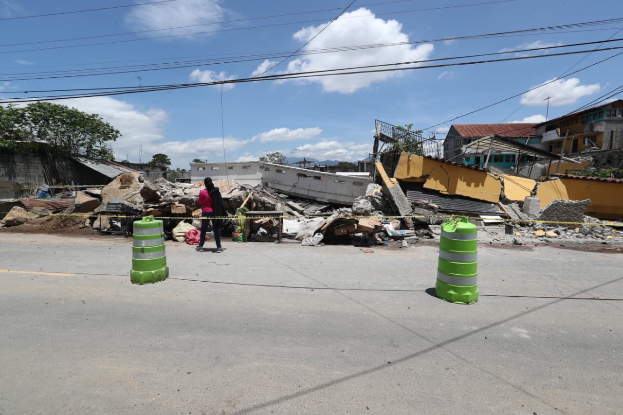
During the 2023 rainy season, they identified themselves again 182 collapsed homes that were on the banks of the Pinula Riveran area classified for years as vulnerable to landslides and erosion.
In 2026, according to residents of the sector, there is knowledge of at least 80 collapsed homes as a consequence of the instability of the terrain. Conred pointed out that it does not have data on damage to homes in that area because it is a high-risk, uninhabitable site.
Prensa Libre consulted the National Coordinator for Disaster Reduction (Conred) on the number of affected homes and affected families. The institution indicated that this record corresponds to the Municipal Coordinator for Disaster Reduction (COMRED).
“Governmental Agreement 179-2001 identifies high-risk areas (including the Villa Hermosa area) and the count of affected homes corresponds to COMRED”
National Coordinator for Disaster Reduction (Conred)
The area is classified as high risk
According to information from the Ministry of Communications, Infrastructure and Housing (CIV)the area was never formally authorized for housing. The entity’s spokesperson explains that since the late 1990s, when the sector began to be populated, the Unit for the Development of Popular Housing (Udevipo) The place had already been identified as high risk and therefore did not issue property titles.
For its part, the Conred remember that the Government Agreement 179-2001 classifies this sector of Villa Hermosa as a risk area. The regulations warn about the danger of building less than 100 meters from the Pinula River.
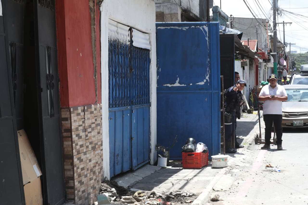
The institution indicated that it has maintained contacts with the municipalities included in said agreement. During his most recent visit to Villa Hermosa 1, zone 7 of San Miguel Petapa, it was found that most of the homes remained uninhabited. In addition, a family that was still in the place agreed to self-host with relatives.
Who should attend to this situation?
According to Conred, the family transfer processes have already begun and are part of the operation of the Tiered Systemwhich involves local, municipal, departmental and national authorities.
RELATED READINGS

Covial reiterates that, as it is a municipal area not intended for housing, the procedures and recovery processes correspond to the Municipal Coordinator for Disaster Reduction (COMRED).
After the incidents that occurred in 2023, the Municipality of San Miguel Petapa published a Council minute in which it notified the neighbors about the high risk of the area and requested evacuation.
During the last few days, the municipality set up a temporary shelter in a warehouse for the affected families. However, at the close of this note, the administration of Mayor Maynor Morales Chávez on the extent of the homes and families affected, what has been done since 2023 and what the plan was for the future.
In similar cases, as explained by the CIV, it is the Ministry of Social Development the person in charge of activate technical tables and coordinate support for affected families. However, at the close of this publication, the entity had not yet confirmed whether this protocol had already been activated or requested.
How to know if a home is in a risk area?
La Conred recalls that Guatemala is considered one of the countries with the greatest vulnerability to natural disasters in the region. For this reason, the institution keeps municipal maps of susceptibility to landslides and floods available so that the population can consult the level of risk in the area where they reside: https://conred.gob.gt/mapas-de-riesgo/