
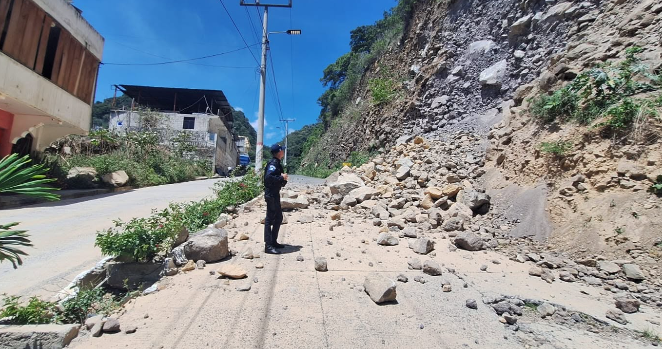
The 7.4 magnitude earthquake that occurred off the coast of Chiapas, Mexico, on Friday, July 17, once again reminded that Guatemala is among the countries with the highest seismic activity in the region. However, specialists from the Guatemala Seismological Service (SSG) at the Mariano Gálvez University explain that not all earthquakes produce the same effects, even when they register similar or greater magnitudes.
Guatemala was shaken last Friday by two seismic movements. The first occurred at 7.20 hours and reached a magnitude of 5, with the epicenter in the Pacific Ocean, according to the National Institute of Seismology, Volcanology, Meteorology and Hydrology (Insivumeh). An hour and a half later, at 8.48 hoursthe country was shaken again by a movement of magnitude 7.4, whose epicenter was located off the coast of the Mexican state of Chiapas, near the border with Guatemala.
Initially, the Insivumeh preliminarily reported a 5.6 magnitude earthquake with its epicenter in Quetzaltenango. Later, after reviewing the records, he determined that both reports corresponded to the same earthquake that originated off the Mexican Pacific coast.
The magnitude does not determine the damage
According to the Seismological Service of Guatemala, one of the most common errors is to directly associate the magnitude of an earthquake with the level of destruction it can cause.
Specialists explain that damage depends on several factors. These include the depth at which the earthquake originates, the distance between the epicenter and the towns, the geological characteristics of the terrain and the vulnerability of the buildings.
For this reason, a large earthquake, but distant from the national territory, can be felt with less intensity than a smaller magnitude earthquake whose epicenter is located near populated areas.
Added to this is the so-called site effect, a phenomenon through which some types of soil amplify seismic waves, which increases the intensity of the movement in certain areas.
This combination of factors explains why the approximately magnitude 6.8 earthquake recorded in Guatemala in 2022 caused significant casualties and damage, while other larger magnitude events produced considerably smaller effects in the country.
Guatemala has always been a seismic country
The Guatemalan Seismological Service also rules out that the country is currently experiencing an unprecedented number of tremors.
According to specialists, Guatemala has historically maintained high seismic activity due to the interaction of the Cocos, Caribbean and North American tectonic plates.
That activity is reflected in the most recent statistics. With data projected as of July 17, 2026, the country has accumulated 3,730 earthquakes so far this year, of which 83 were perceived by the population. Specialists clarify that these figures do not necessarily mean that Guatemala is shaking more than in the past, but rather that today there is a much greater capacity to detect and record seismic movements.
Currently, denser monitoring networks, more sensitive instruments and systems operate that allow information to be processed in real time. Added to this is the immediate dissemination through the media and social networks, so practically any movement is known by the population.
As a consequence, many low-magnitude earthquakes that went unnoticed decades ago are now recorded and publicly reported.
The country’s seismic history confirms this condition. Among the most remembered earthquakes are the Santa Marta earthquake, which occurred in 1773, which destroyed a large part of Santiago de los Caballeros; the earthquakes of 1917 and 1918, which caused serious damage in the Nueva Guatemala de la Asunción; the 1976 earthquake and the San Marcos earthquake of 2012.
The proximity of the epicenter makes the difference
When comparing earthquakes such as the 2012 San Marcos earthquake, the 2017 Chiapas earthquake, the 2020 Oaxaca earthquake and the one recently recorded off the Mexican coast, the Guatemala Seismological Service points out that distance is one of the most determining factors.
The San Marcos earthquake occurred much closer to the towns in the west of the country, which is why it produced more intense ground movements and greater damage.
In contrast, the 2017 Chiapas and 2020 Oaxaca earthquakes, although they reached similar or higher magnitudes, had more distant epicenters. As seismic waves propagate, they lose energy, so they reach Guatemala with less intensity.
Most earthquakes originate within the country
The Insivumeh seismic catalog records corresponding to the period 2016-2025 show that the 85.1% of the strong earthquakes felt in Guatemala had their epicenter within the national territory.
During that period, they registered 1,216 events with epicenter in Guatemala, while 213 earthquakes, equivalent to 14.9%originated in neighboring countries such as Mexico, El Salvador and Nicaragua.
The regions with the greatest seismic activity include the Pacific coast, the volcanic chain, the central region, as well as the north and northeast of the country, where important geological fault systems are located.
The Seismological Service of Guatemala also estimates that between 70% and 75% of historically recorded earthquakes originate in the Pacific subduction zone, where the Cocos plate inserts beneath the Caribbean plate.
The remaining percentage is mainly associated with geological faults located within the national territory, including the Motagua and Polochic systems and faults related to the volcanic chain.
Specialists explain that Friday’s earthquake had a magnitude of 7.4which corresponds to a large event. Furthermore, it originated at a depth of 12 kilometersconsidered relatively superficial.
However, the epicenter was located more than 100 kilometers of Guatemalan territory, which reduced the intensity with which the movement was perceived in the country. The effects also varied according to soil type and building conditions.
The Seismological Service of Guatemala remembers that the terms earthquake, shaking and earthquake describe the same geological phenomenon, although in everyday language “earthquake” is usually used to refer to events of greater intensity or with destructive consequences.
The event occurred in a subduction zone, where the Cocos plate pushes beneath the upper tectonic plate.
Specialists explain that the friction between both plates can keep them blocked for long periods, accumulating energy. When this energy is released suddenly, seismic waves are produced that generate the earthquake.
The subduction zone located off the Pacific coast is one of the main sources of seismic activity in Guatemala. According to the recent catalogs of the Guatemala Seismological Service, among the 70% and 80% of the recorded earthquakes originate in that tectonic environment.
Replicas are part of the process
The Seismological Service of Guatemala explains that the aftershocks are subsequent earthquakes related to the readjustment of the area where the main rupture occurred.
For this reason, it is normal for a 7.4 magnitude earthquake to produce numerous aftershocks during the hours or days after the event.
*Stay up to date with the Now newsletter. Key information at the moment it happens. Subscribe here.