
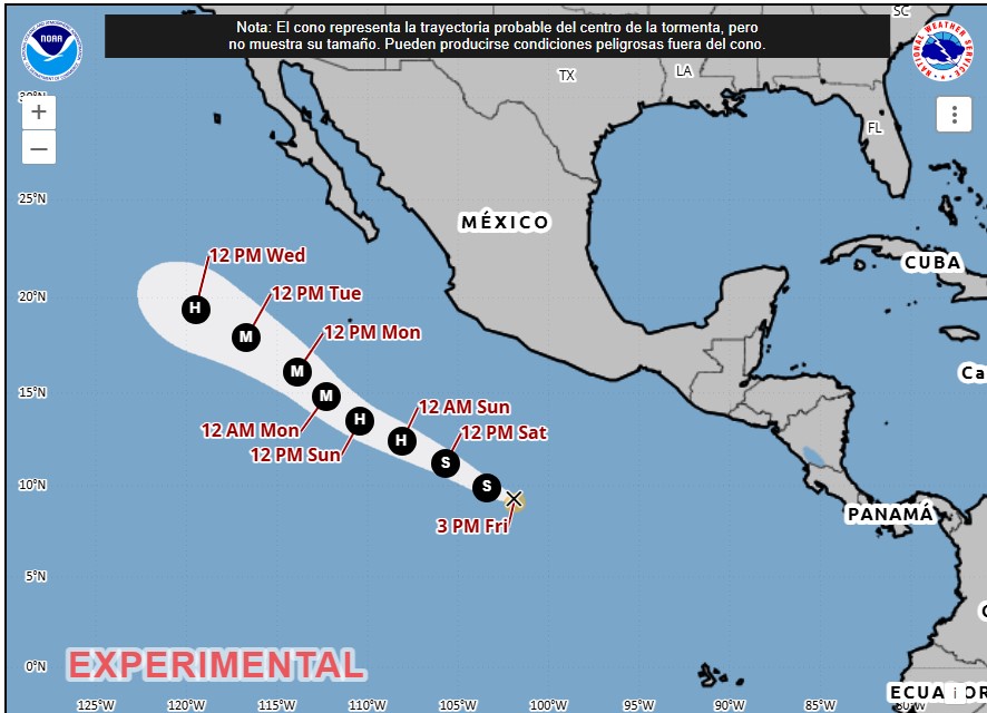
The US National Hurricane Center (NHC) reported that Tropical Storm Genevieve formed on the afternoon of this Friday, July 24, in the Pacific Ocean and gave details of its location and trajectory.
According to the NHC report, at 5 p.m. (Miami time), Genevieve was located 945 kilometers from Zihuatanejo, Guerrero, Mexico, with maximum sustained winds of 75 kilometers per hour and tropical storm force winds that extend up to 75 kilometers.
The report adds that the tropical storm is moving west-northwest at a speed close to 20 kilometers per hour. In addition, it is forecast to strengthen significantly in the coming days, to the point that it could reach hurricane status over the weekend.
The NHC does not expect Genevieve to make landfall. For its part, the National Meteorological Service (SMN) of Mexico reported that the system does not represent danger to that country due to its distance and trajectory.
So far, no warnings or alerts have been issued for any territory that may be affected by the passage of Genevieve.
*Stay up to date with the Now newsletter. Key information at the moment it happens. Subscribe here.