
The strong earthquake that surprised Guatemalans this morning July 17, 2026 had a magnitude of 7.4 and a depth close to 10 kilometersaccording to data from Seismological Service of Guatemala (SSG)associated with the Mariano Gálvez University (UMG).
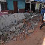
The movement occurred at 8:48 hours and it was intense enough for hundreds of people to leave buildings, offices and homes as a preventive measure. Videos began to circulate on social networks showing evacuations and the moment when the tremor was perceived in different parts of the country.
Since the Institute National Seismology, Volcanology, Meteorology and Hydrology (Insivumeh) updated the magnitude of the earthquake during the afternoon of July 17, this note takes this updated data as a reference (7.4), although the images shared by the Guatemala Seismological Service (SSG) do not yet reflect this update.
The magnitude 7.4 indicates that it was a large earthquake. The depth of 12 km means that it originated relatively close to the surface. However, as the epicenter was located more than 100 km from Guatemalan territory, the distance reduced the intensity of the movement in the country. The type of soil and the vulnerability of the buildings also influence.
Víctor Tzorin, from the Guatemala Seismological Service (SSG)
Where did the earthquake originate?
According to information shared by the SSGhe epicenter is located at 86 kilometers west-southwest (WSW) of Puerto Madero, Mexicooff the coast of the Pacific Ocean.
| Magnitude | Depth | Date | Hour | Epicenter |
| 7.4 | 10km | 07/17/2026 | 8:48:38 am | 86 km WSW of Puerto Madero, Mexico |
Why did the earthquake occur?
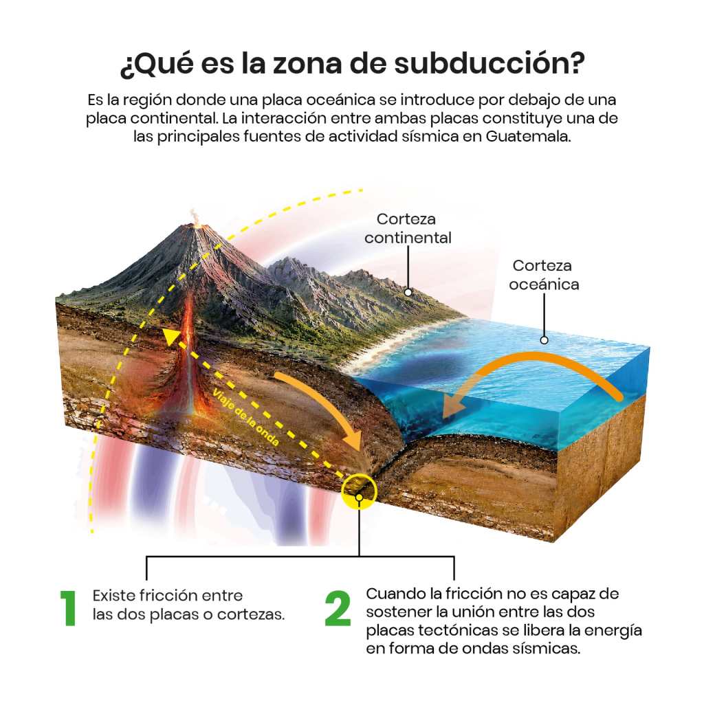
He Guatemala Seismological Service explained that the event was generated in the subduction zonewhere the coconut plate moves below the Caribbean plate.
RELATED READINGS

Based on the technical information shared by the UMG service, this contact between both plates accumulates large amounts of energy and when the friction stops supporting that pressure, the energy is suddenly released and propagates through seismic waveswhich are responsible for the movement perceived on the surface.
For its part, Edwin Rojas, director of Insivumeh, explained at a press conference that geological dynamics is one of the reasons why Guatemala It registers constant seismic activity and is part of one of the regions with the highest frequency of tremors in Central America.
This is how it felt in Guatemala
For his part, Víctor Tzorin, from the SSG, clarified that although the epicenter reached a magnitude of 7.the intensity with which it was perceived changed as the seismic waves advanced towards Guatemalan territory.
Despite his magnitude of 7.4the intensity of the earthquake decreased as it spread towards Guatemala due to the distance from the epicenter, in addition to the conditions of the soil and buildings.
Víctor Tzorin, Guatemala Seismological Service
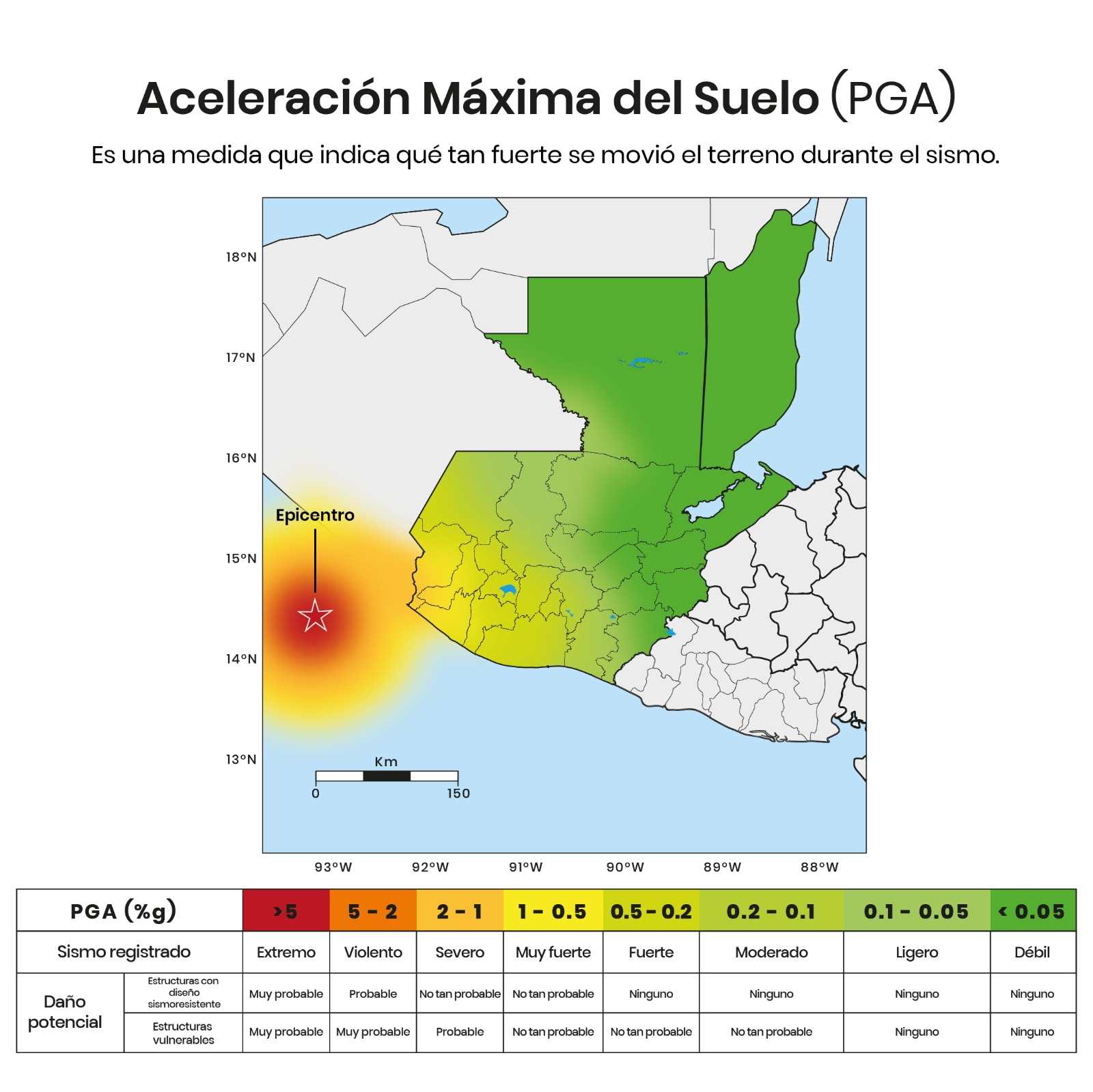
Tzocín explained that the Maximum Ground Acceleration (PGA) map shows the areas with more or less movement during the earthquake. Red and orange colors indicate greater intensity near the epicenter, while green colors reflect less shaking.
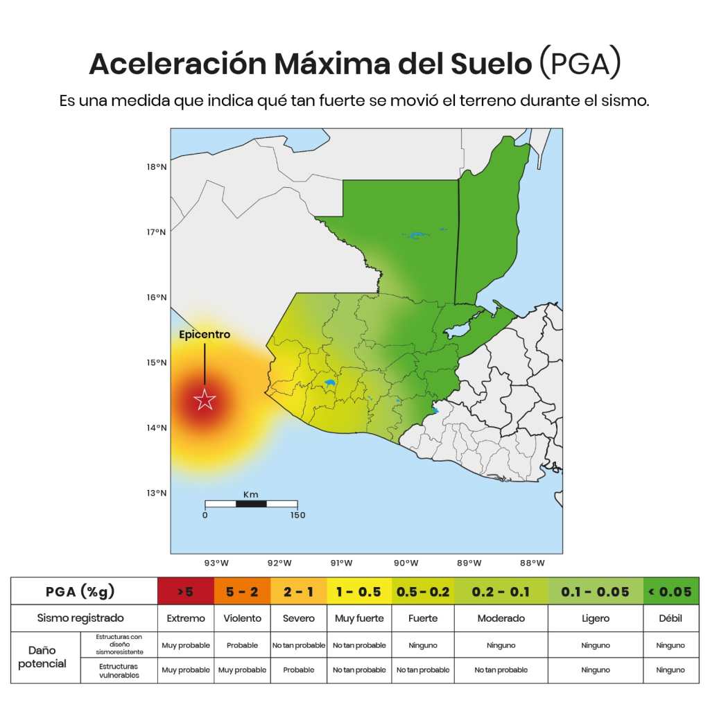
According to the image created by SSGthe first areas to feel the movement most strongly were the coast of Saint Markas well as sectors of Retalhuleu and Quetzaltenangowhere the intensity varied between severe, very strong and strongdepending on the place and as you moved away from the epicenter, the sensation of movement and intensity was perceived differently.
The Conred He added that the tremor was also noticeable in Chimaltenango, Escuintla, Sacatepequez, Huehuetenango, Suchitepequez, Guatemala, Totonicapan and The Progressamong other departments.
What is the difference between an earthquake and an earthquake?
Although in everyday language they are often used as different words, the SSG and the Conred point out that, from a technical point of view, earthquake and earthquake They refer to the same phenomenon: the movement of the Earth’s crust.
The difference is in the use to which they are given. The term earthquake It is usually used when the event causes considerable damage, while earthquake It is the general concept to describe any telluric movement, regardless of its intensity or its consequences.