
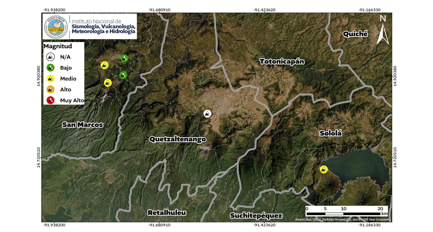
The National Institute of Seismology, Volcanology, Meteorology and Hydrology (Insivumeh) reported that the 7.4 magnitude earthquake, recorded on the morning of Friday, July 17 off the coast of Chiapas, Mexico, caused at least six mass earth movements or landslides in western Guatemala.
According to the preliminary report of the Seismology Section of the Department of Geophysics, the landslides occurred in four points in the department of San Marcos, one in Quetzaltenango and one in Sololá.
The report indicates that these data are preliminary and are part of the evaluation of the effects generated by the earthquake, whose epicenter was located in the Pacific Ocean, off Chiapas, Mexico, at a depth of 18 kilometers.
The earthquake also caused a sequence of aftershocks and a tsunami threat for the Guatemalan Pacific coast, which was later ruled out.
The landslides were recorded in the section “Mass Movements” of the technical document, where the Insivumeh specifies the location of the events through a map made with information collected after the earthquake.
The National Coordinator for Disaster Reduction (Conred) was consulted to find out if, after the identification of these six landslides by Insivumeh, preventive measures were activated in the affected areas.
Among the queries posed to the institution are whether the identification of communities at riskthe elaboration or activation of evacuation planspreventive evacuations, recommendations aimed at the population and the evaluation of routes that could be blocked or collapsed due to new landslides. The Conred has not yet responded to the queries.
According to Insivumeh, seismic activity continues in the epicentral region due to the aftershocks associated with the main event, which is why it maintains permanent surveillance and recommends that the population stay informed only through official sources.
*Stay up to date with the Now newsletter. Key information at the moment it happens. Subscribe here.