
Two days after magnitude 7.4 earthquakeperceptible in a large part of the Guatemalan territory, recorded off the Pacific coast, seismic activity continues. He National Institute of Seismology, Volcanology, Meteorology and Hydrology (Insivumeh) reported that, until 7 a.m. this Sunday, July 19, there were 206 earthquakes associated with this seismic sequence, of which 30 were sensitive for the Guatemalan population.
According to the institution’s seismological bulletin, the magnitudes of the recorded events range between 2.6 and 7.4the latter being the main earthquake that occurred on Friday, July 17.
Only during Saturday, July 18, the Insivumeh record 125 earthquakesof which 12 were perceived by the population in different parts of the country.
Seismic sequence
Main Earthquake Magnitude 7.4
from July 17, 2026 to July 19, 2026
Issue date: Sunday 2026-07-19 07:00 local time#SomosINSIVUMEH #PassionForScience #ElPuebloDignoEsFirst #CIV pic.twitter.com/6Wjm5fZXrG— INSIVUMEH (@insivumehgt) July 19, 2026
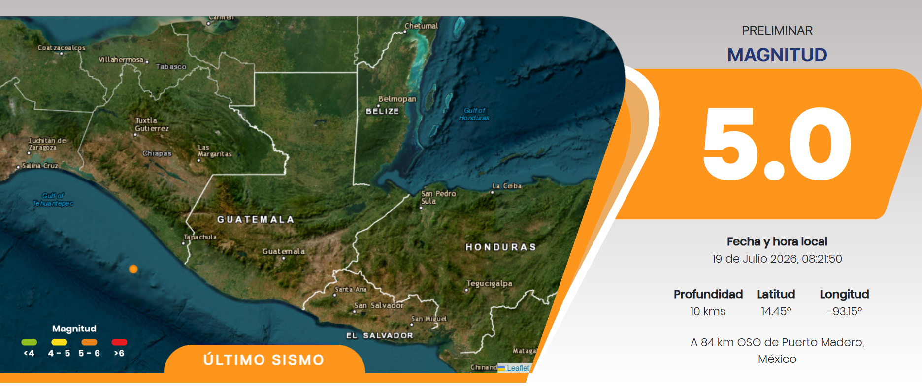
For its part, real-time monitoring of the Seismological Service of Guatemala (SSG) reported that the most recent earthquake this Sunday occurred at 8:21 a.m.with a magnitude of 5.0 and one depth of 10 kilometers. The epicenter was located at 84 kilometers west-southwest (WSW) of Puerto Madero, Mexico.
Why do the aftershocks continue?
The geologist Victor Tzorinof the SSG, explained that the replicas correspond to the natural process of readjustment of geological faults after the main rupture.

“Aftershocks are subsequent earthquakes related to the readjustment of the area where the main rupture occurred. It is normal for an earthquake of this magnitude to produce numerous aftershocks,” said the specialist.
Where did the earthquake originate?
According to the SSG, the main earthquake occurred on July 17, 2026 at 8:48:38 a.m.with a magnitude of 7.4 and one depth of 10 kilometers. Its epicenter was located 86 kilometers west-southwest of Puerto Madero, Mexicooff the coast of the Pacific Ocean.
Despite the high magnitude, Tzorin explained that the distance between the epicenter and Guatemalan territory contributed to reducing the impact. Although at least six landslides and some families were affected, Damage was limited compared to other earthquakes of similar magnitude.
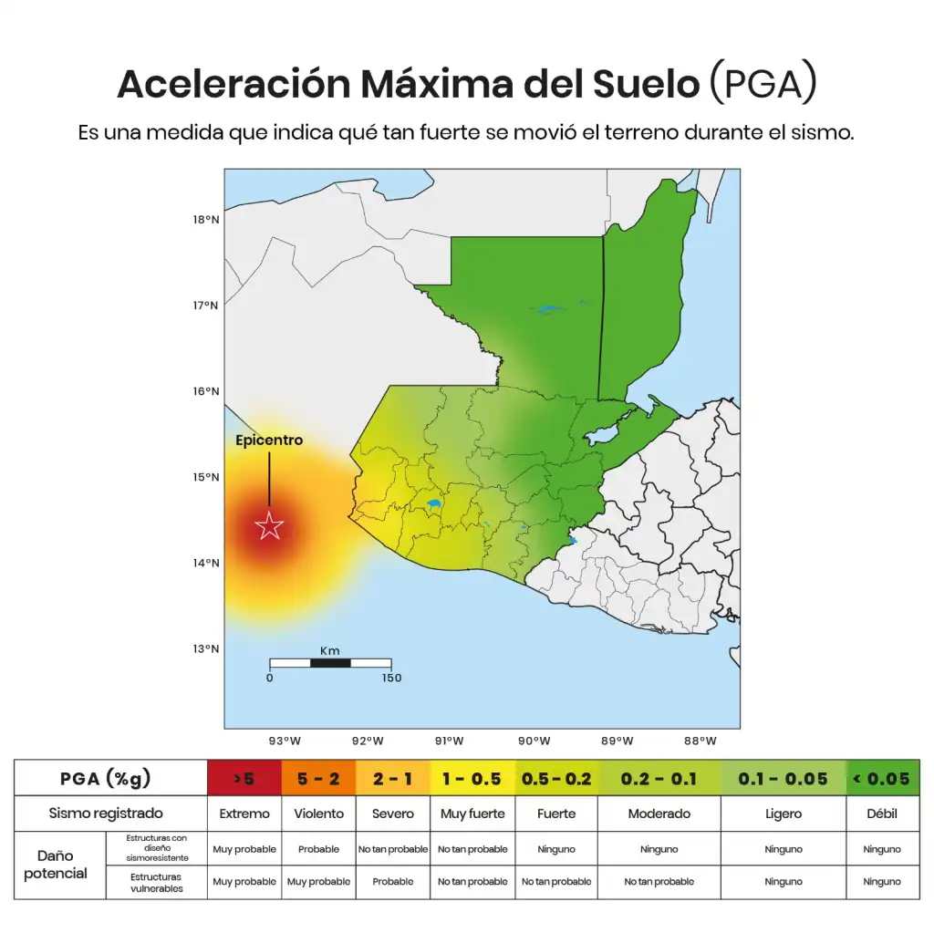
The specialist also explained that the map of Maximum Ground Acceleration (PGA) allows you to identify the intensity with which the ground moved during the earthquake. The colors red and orange represent the areas where the shaking was most intense, mainly near the epicenter, while the green tones reflect weaker movements as distance increases.